Fighting our way through the weather I got to Tourist Info and grabbed a map. I happened to notice a few walks outlined on it, and since it's "our thing", Peter and I decided to give it a go.
There's a steep little mountain right alongside the port, and the walk route seemed to be heading to the top. Looking up, we didn't think we'd get any where near the top, after all we were on holiday and just fancied stretching the legs a bit. We set off to reach the first view point marked on our map, it's quite low down on the hill.
And it was really easy to get to. The Norwegians obviously feel that everyone should be able to reach these places, and a ramp had been installed all the way up. If you were fit enough, I think you might be able to get a wheelchair or pushchair up to the viewing point
 |
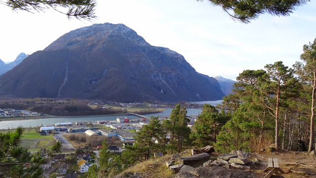
| Looking out from the first viewpoint, An easy walk with a ramp to get you to here. That's Romsdalsfjorden in front of us. |
 |
| View from the log shelter. That mountain across the river is called Varden (I think) |
The Norwegians really do like to help people do these things, there were rails and chains on several parts of the walk. If you look at the photo above, you can see a rail running diagonally just up and to the right of Peter.
There are boxes containing notebooks in which you add your name to the list of people who got that far.
They've installed rock staircases around many of the awkward bits. And we still kept going up, stopping to enjoy the views time and time again.
We knew there was another view point quite a way above us. As we got higher, we met other passengers coming down, they told us what to expect. The last couple we came across told us about a platform that they'd seen from below. We kept going up
Once we'd seen the platform, we had to carry on. Bear in mind that I am wearing me jeans, and although we've brought some extra layers and we are both wearing decent walking shoes, we have no water or food with us. We'd agreed that we'd keep going until 12.30, at which point we would turn round and go back down, and not worry about how far we got. We were thirsty though, luckily there were loads of icicles about, and we also found a spring marked drinking water (we think) just a few feet below the platform.
Anyway we got to the viewing platform - 537 m above sea level, that's 1761 feet.
And yes I did walk out to the end. I even walked on the scary bit where you can see through the floor, but only a foot or so. I didn't like it. The views were just as wonderful as expected.
Anyway, we went a little bit further up - I reckon we probably added another 100ft or so onto the height. It is easy to do because of the rock staircase our Norwegian hosts have built. The only issue is that it's a little bit exposed.
But it was absolutely wonderful! We were so lucky with the weather. There was no wind, the sun was out, and it was glorious. (I don't think I'd be sitting so comfortably if we'd have felt the wind like we did down on the port)
 |
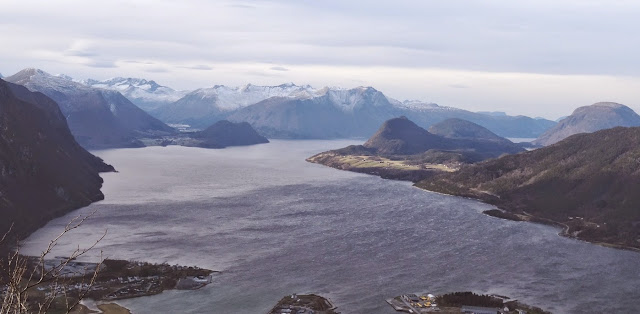
| Looking out from the height of our climb. I think the mountain we're on is called Nesaksla |
 |
| A beautiful day. Just fantastic |
We pottered around the town before going back to the ship, it didn't seem to have a lot to offer us during our quick look see, and then we were back on board, satisfyingly tired, in that good way you get.
Here's a picture of the mountain, I've marked where the platform is (lower arrow), and my guess as to where I think we got to. As you can see, we still had quite a climb to reach the top if we'd have continued. Nesaksla is 715m or 2345 ft high.
Peter and I have decided that if we come this way again, and the weather is right, we'll do it properly and reach the summit.
Anyway, that was Andalsnes. I think I enjoyed this port more than most. Tomorrow we're in Bergen, I wonder what that will be like?


No comments:
Post a Comment